OneView Tools
Tools are accessed via the Tools button  on the OneView toolbar:
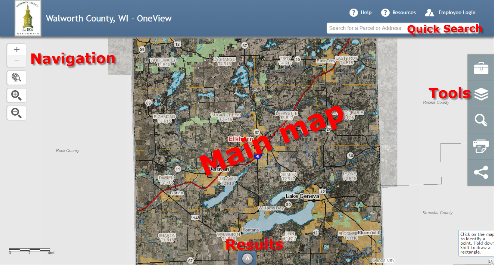
Navigation
Navigation tools  are discussed in the Getting around the map section.
Identify
The Identify tool  allows the user to retrieve information about features on the
map. Click the Identify tool icon to select it, then click on the map to Identify on
all visible layers (default action). Information
related to geographic features where the user clicked will be presented in the
Results Panel at the bottom of OneView:
allows the user to retrieve information about features on the
map. Click the Identify tool icon to select it, then click on the map to Identify on
all visible layers (default action). Information
related to geographic features where the user clicked will be presented in the
Results Panel at the bottom of OneView:
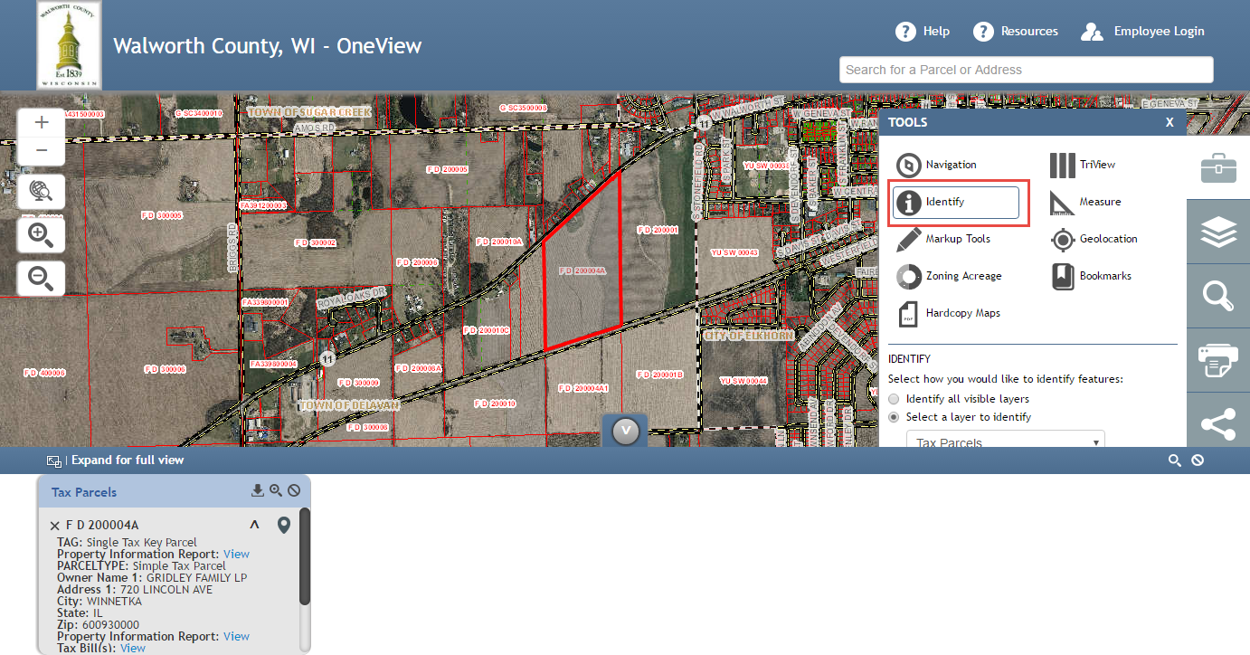
Identify results shown in the Results Panel.
To Identify on a specific layer, select that layer from the dropdown menu:
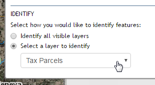
Select a single layer to Identify on.
Note
If results are not available in the location clicked, none will be returned and displayed in the Results Panel.
Note
It is possible to return multiple result sets for a single area. Each result set will typically be from a unique map layer.
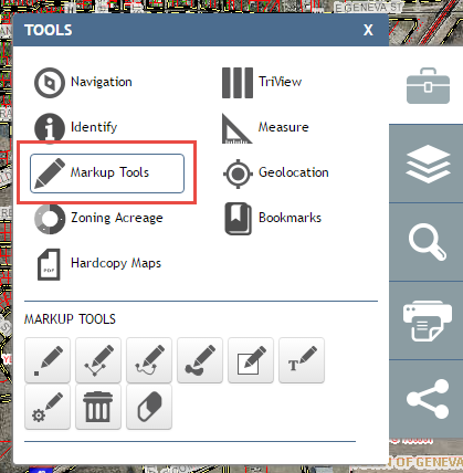
Markup Tools
OneView’s Markup Tools  are for placing shapes and text on the map. These
tools can be seen below. Hover over each icon in OneView for the name of the tool.
Click on the tool to activate it. The controls have help that either will show up
below the tool icons (Edit Graphics) or as a tooltip on the mouse icon (Point,
Line, Polygon).
are for placing shapes and text on the map. These
tools can be seen below. Hover over each icon in OneView for the name of the tool.
Click on the tool to activate it. The controls have help that either will show up
below the tool icons (Edit Graphics) or as a tooltip on the mouse icon (Point,
Line, Polygon).
Zoning Acreage
The Calculate Zoning Acreage tool  allows users to see what the different zoning
districts are for a specific parcel along with how many acres each zoning distict
represents.
allows users to see what the different zoning
districts are for a specific parcel along with how many acres each zoning distict
represents.
Select the Zoning Acreage tool from the Tools menu:
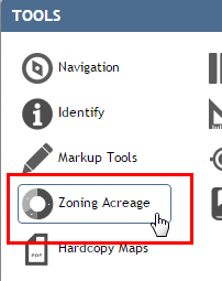
Selecting the Zoning Acreage tool.
Select the Point tool to click inside a parcel:

Selecting the point tool.
Click inside any parcel to view the various zoning districts along with acreage for each represented:
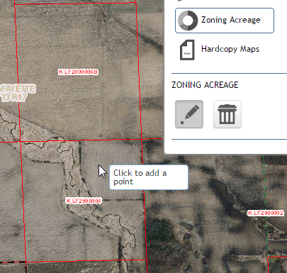
Click to add a point.
The zoning district acreage will be shown in the results window of the Calulate Zoning Acreage Tool:
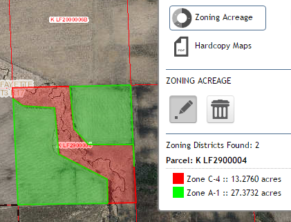
Zoning District acreage results.
Hard Copy Maps
The Hard Copy Maps tool  allows users to access pre-made large format PDF maps.
These maps are created based on a theme (Cadastral, Zoning, Zoning W/ Parcel
Lines, etc) for the entire County. These PDF Maps can be saved or printed.
allows users to access pre-made large format PDF maps.
These maps are created based on a theme (Cadastral, Zoning, Zoning W/ Parcel
Lines, etc) for the entire County. These PDF Maps can be saved or printed.
Select the Hard Copy Maps tool:
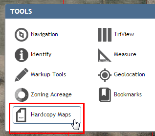
Selecting the Hard Copy Maps tool.
Select a layer that you would like to gain access to.
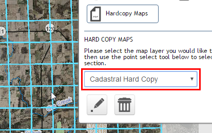
Selecting the layer.
By selecting a specific layer/theme, a grid will be displayed on the map.
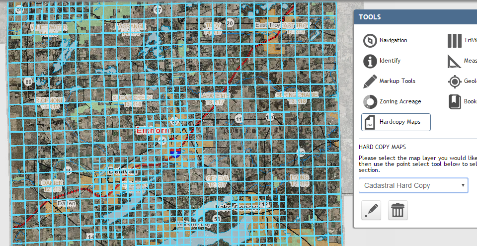
The grid available for chosen layer.
Finally, click in one of the sections of the grid to gain access to that specific prerendered PDF Map.
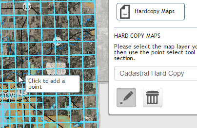
Click to select a section.
Once the PDF map opens, you can save or print the map. Most maps will be created in 34X44 size format.
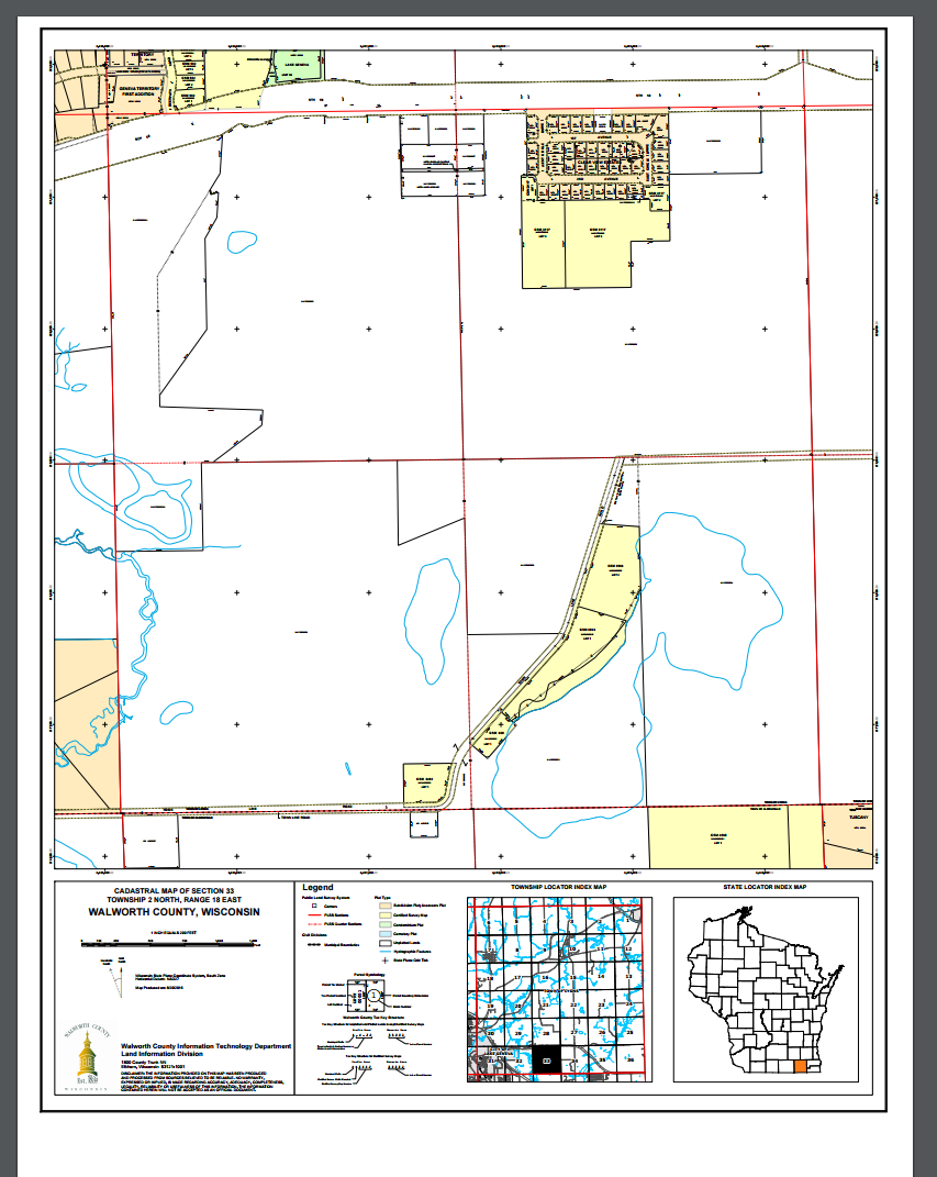
The resulting PDF map.
Bookmarks
Bookmarks  allow you to save spatial extents by name so you can conveniently
come back to them later.
allow you to save spatial extents by name so you can conveniently
come back to them later.

The bookmarks tool.
By default, there are several predefined bookmarks. To zoom to a bookmark, click on the bookmark name:
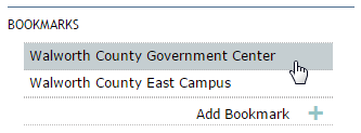
Selecting a bookmark.
User-defined bookmarks can also be added with the “Add Bookmark” link.
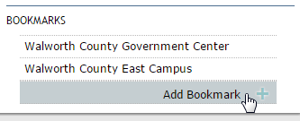
Add a user-defined bookmark.
Give your bookmark a name, and hit Enter:
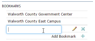
Creating/naming a user-defined bookmark.
To rename a user-defined bookmark, click the pencil icon. To permanently delete a user-defind bookmark, click the “x” button. Deleting a bookmark is an irreverible process.
Warning
User-defined bookmarks will remain in your application until you clear your browser cache. Once your browser cache is cleared, user-defined bookmarks will be erased and are unrecoverable.
TriView
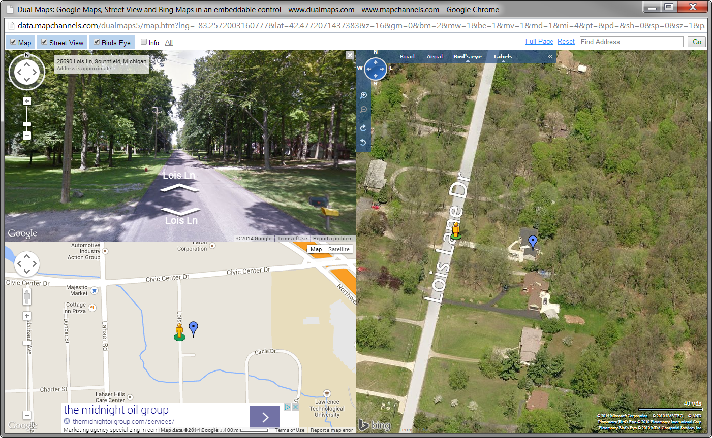
TriView  is a unique feature of OneView that allows the user to select a point on
the map and view it in Google Map view, Google StreetView, and Bing bird’s eye
view. To use TriView, select the TriView tool, and click on a point on the map.
You will be presented with a new browser window displaying TriView for that
location:
is a unique feature of OneView that allows the user to select a point on
the map and view it in Google Map view, Google StreetView, and Bing bird’s eye
view. To use TriView, select the TriView tool, and click on a point on the map.
You will be presented with a new browser window displaying TriView for that
location:
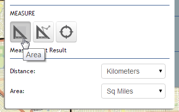
Measure
OneView Measure tools  allow the user to measure area and length on the map along
with acquiring the latitude and longitude of a point location clicked on the
map.
allow the user to measure area and length on the map along
with acquiring the latitude and longitude of a point location clicked on the
map.
Geolocation
Geolocation  will find the users location if they are located within the extent
of the default map extent.
will find the users location if they are located within the extent
of the default map extent.
Note
Geolocation does not move with the user.