Map Layers
What is a map layer?
A map layer represents a particular theme of geographic data, such as roads, parcels, streams, or city boundaries. These themes of data are then stacked upon one another, or layered, showing how they all relate to one another.
OneView map layers
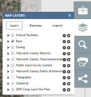
Map layers are accessed through the Layers tool  in the OneView
toolbar. Layers can be turned off/on and made more/less transparent. Through
the “Basemap” button, different basemap layers can be chosen. The map legend can
also be viewed through the “Legend” button.
in the OneView
toolbar. Layers can be turned off/on and made more/less transparent. Through
the “Basemap” button, different basemap layers can be chosen. The map legend can
also be viewed through the “Legend” button.
Note
The Legend respects what layers are currently visible in the application.
Basemap layers
OneView contains basemap layers of aerial imagery for Walworth County for the following years:
- 2015 (default basemap)
- 2010
- 2005
- 1995
- 1990
- 1985
- 1980
- 1975
- 1970
- 1963
- 1956
- 1940
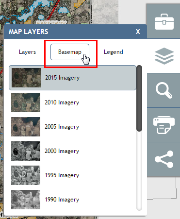
Basemap layers available.
Single-clicking a year will change the basemap to that year.
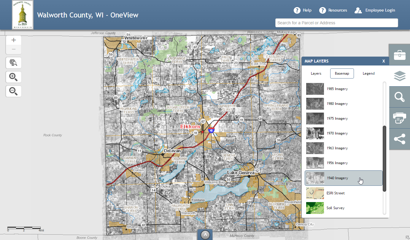
Clicking 1940 Imagery changes the basemap to imagery for that year.