Resources
The Resources toolset contains several tools:
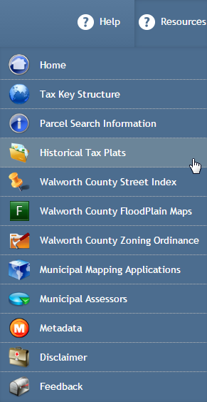
The Resources toolset.
Home
Select the Home button to open the Walworth County Web Site in a new Web browser instance.
Tax Key Structure
Select the Tax Key Structure button to view descriptive information on the structure of the Walworth County Tax Key’s.
Parcel Information Search
Select the Parcel Information Search button to open an seperate application to simply search by Walworth County Tax Keys. This application provides a quick search option to view the Ownership, Survey’s, Tax Bill’s and Doucment History without viewing a map. You can access the Walworth County Web Mapping application from this Parcel Information Search website.
Historical Tax Plats
Select the Historical Tax Plats button to open an application that allows the user to view Historical Tax Plats from Walworth County. This link is useful for users who want to see where a subdivision or Tax Plat map orginated from and how it was platted.
Walworth County Street Index
Select the Walworth County Street Index button to view a list of streets for Walworth County. This link is useful for users to see how streets are spelled in Walworth County which will make address searches in the Web Mapping Application easier.
Walworth County Floodplain Maps
Select the Walworth County Floodplain Maps button to open an application that gives users the ability to open a DFIRM panel from FEMA. DFIRM panels are used to determine wetland designations. This Floodplain application provides a map that allows you to click on an area and access the DFIRM panel in PDF format.
Walworth County Zoning Ordinance
Select the Walworth County Zoning Ordinance button to open the Walworth County Zoning Ordinance. This link is useful for users looking to find out what the regulations are for a specific zoning district on a parcel.
Municipal Mapping Applications
Other Walworth County city web mapping applications.
Municipal Assessors
County Assessor directoy.
Metadata
Select the Metadata button to view descriptive information about each map layer available for display within the application.
Disclaimer
Select the Disclaimer button to view the disclaimer text display upon first opening the application.
Feedback
Select the Feedback button to open a new Microsoft Outlook email, addressed to the Walworth County Web Site Administrator. Provide any desired feedback regarding the Walworth County mapping application, including any identified errors.