Introduction
What is OneView?
OneView is a web mapping application which allow users to view and interact with spatial (place) and attribute (information about places) data. Spatial data makes up the map layers you see on the map, and these map layers have attributes that describe them and provide information. The sections of this help documentation describe how to use OneView to view the map layers and associated data and information. The main areas of OneView are shown below:
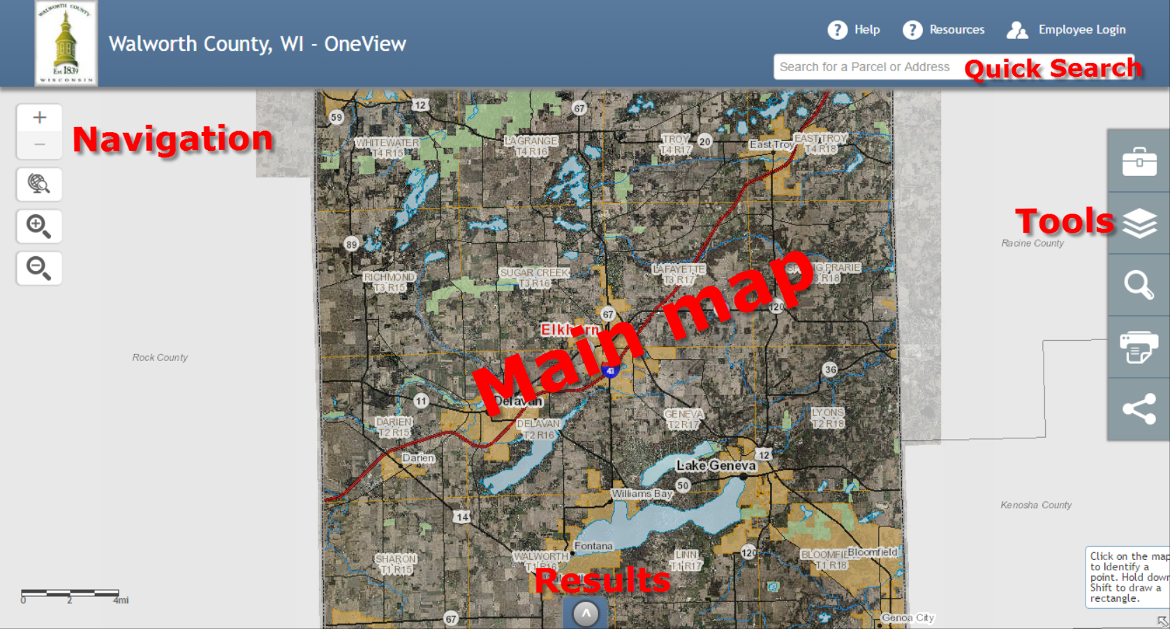
The main areas and features of the OneView mapping application.
Minimum system requirements
OneView works in the following web browsers ONLY:
- Internet Explorer 9+
- Chrome
- Firefox
- Safari
Limitations
Warning
When using this application with Internet Explorer please make sure that compatibility View is disabled.
OneView provides the general public local government property tax and assessment information, planning and zoning data, environmental, utility and government services information.
To find a location, simply enter an owner name, address or parcel number in the search box and select from the list.
Disclaimer
The Walworth County Land Information GIS website provides online access to Walworth County land information. The information provided in this application has been produced and processed from sources believed to be reliable. No warranty, expressed or implied, is made regarding accuracy, adequacy, completeness, legality, reliability or usefulness of this information. The information contained herein will not be accepted as an official document. Walworth County shall assume no liability for:
- Any errors, omissions, or inaccuracies in the information provided regardless of how caused; or
- Any decision made or action taken or not taken by reader in reliance upon any information or data furnished hereunder.